

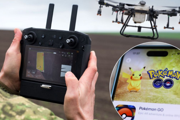
Pokemon Go military drones is not a headline anyone who spent years catching Pikachu expected to encounter, but it is the story that Dutch newspaper Trouw broke in June 2026, and it is being confirmed by multiple outlets. Hundreds of millions of Pokemon Go players spent years filming the streets, parks, and buildings around them to earn in-game rewards. Those roughly 30 billion environmental scans are now owned by Niantic Spatial, and they helped train a camera-based navigation system that a U.S. defense contractor is preparing to put into drones and other military robots. Most of the players had no idea.
What Pokemon Go Players Actually Scanned — And Where It Went
Since 2021, Pokemon Go has asked players to record short videos of real-world locations called PokéStops to earn extra in-game items. Scanning buildings, streets, and surrounding objects in a 360-degree sweep was optional, and Niantic asked separately for permission to keep the footage. Granting it meant agreeing to extra terms.
Those terms handed Niantic a transferable, sublicensable license to the scans, meaning the company could resell the imagery to third parties. Floris De Hingh, a 34-year-old Dutch player who downloaded the game on its first available day in 2016, told Trouw he never connected the footage he captured to a system that would steer military drones. He had scanned everything from parks to the inside of his own apartment. “I was just playing a game,” he said.
The collected scans, around 30 billion of them, became the raw material for a Visual Positioning System. Where GPS depends on a satellite signal that can be jammed or spoofed, VPS works out where a camera is by matching what it sees against a detailed 3D model of the world. Two recognizable reference points a few pixels wide can be enough to fix a location. Niantic Spatial’s CTO Brian McClendon, who previously led the team behind Google Maps, Google Earth, and Street View, has said the approach suits robots operating where GPS regularly drops out, including war zones.
Niantic Spatial: From Mobile Game Company to Defense Contractor
Understanding how Pokemon Go data reached the defense sector requires understanding how Niantic restructured itself.
In 2025, Scopely acquired Niantic’s games business, including Pokemon Go, for $3.5 billion. Scopely is owned by Saudi Arabia’s Savvy Games Group and ultimately the kingdom’s Public Investment Fund. The technology platform, including the 30 billion scans and the Visual Positioning System built from them, was spun off as a standalone company called Niantic Spatial under the leadership of John Hanke, Niantic’s founder.
In simple terms: the games went to a Saudi sovereign wealth fund. The map went to defense. The 30 billion scans went with the map.
Niantic Spatial has acknowledged using the player scans to train what it called an “early version” of its navigation model. On the specific defense partnership with Vantor, the company said it had no new information to share. That non-comment is, as DroneXL noted, doing significant work.
What Is a Visual Positioning System and Why Does the Military Want It?
GPS is vulnerable. Electronic warfare units can jam satellite signals, spoof coordinates, or simply overpower the weak signals GPS satellites transmit from 20,000 kilometers above Earth. Modern battlefields, including Ukraine, demonstrate that GPS-denial is now a routine tactical tool rather than an exceptional one.
Visual Positioning Systems solve the GPS problem by not needing satellites at all. A VPS-equipped drone or ground robot uses its camera to match what it sees against a preloaded 3D map. As long as the camera can see recognizable features, the system knows where it is. Jamming does not help an adversary against a navigation system that uses optical matching rather than radio signals.
The 30 billion Pokemon Go scans created one of the largest civilian 3D maps of the world’s streets, parks, and buildings ever assembled. Ground-level camera imagery taken from human height at hundreds of millions of real-world locations provides exactly the kind of reference data a VPS needs to function. The Pokemon Go scanning program was, functionally, a crowdsourced global 3D mapping project, disguised as a reward mechanism inside a mobile game.
Vantor: The Defense Prime Behind the Drone Navigation Deal
Vantor is not a startup. Rebranded from Maxar Intelligence on October 1, 2025, it is a prime contractor to the National Geospatial-Intelligence Agency, holding a follow-on award worth $70 million under the agency’s Global Enhanced GEOINT Delivery program, which serves more than 400,000 U.S. government users.
Vantor’s Raptor software, launched in February 2025, does for aerial navigation what Niantic Spatial’s VPS does for ground-level navigation: it uses a drone’s camera combined with proprietary 3D terrain data to determine position without satellite input. Combined with Niantic Spatial’s ground-level positioning system, a drone overhead and a vehicle or operator below can share the same coordinates in real time with no satellite link.
Vantor’s framing of the problem is direct. The joint release names GPS unavailability, spoofing, interference, and jamming as the vulnerability being addressed, and lists autonomous drones, vehicles, augmented reality glasses, and other field assets as the platforms intended to run on the shared navigation system.
The December 2025 Partnership: What Niantic Spatial and Vantor Agreed To
The Niantic Spatial and Vantor partnership was announced on December 16, 2025, joining the two positioning systems into one architecture. Niantic Spatial handles localization on the ground by aligning a camera feed against its 3D model. Vantor’s Raptor software does the same job in the air. Combined, the companies described a system that allows a drone overhead and a vehicle or dismounted operator below to share coordinates in real time with no satellite link.
Niantic Spatial’s go-to-market lead told defense outlet Tectonic the goal is thousands of devices operating on one coordinate framework in an electronic-warfare-heavy environment. Field testing of the integrated system is planned for early 2026.
The timing matters. The partnership was announced fourteen months after the Pokemon Go scanning terms were introduced in 2021, and four months before Scopely completed its acquisition of the games business. The scans were collected, the 3D model was built, the model was licensed to defense, and then the games were sold separately.
The Consent Problem: Did Players Know Their Scans Could End Up in Weapons?
The core ethical dispute is not whether visual positioning for military drones is a good or bad technology. It is whether the people who provided the training data understood what they were agreeing to.
Jeroen van den Hoven, a professor of ethics and technology at TU Delft, told Trouw the conclusion is hard to avoid. “Without the huge number of scans from all those gamers, the development of this system would never have progressed so quickly,” he said. He added that AI models begin with a dataset and then absorb far more data until the original contributions blur into patterns that can no longer be traced.
Iris Muis, a data-ethics expert at Utrecht University’s Data School, framed the consent trap plainly: a user cannot picture how their data might be used later. Maybe in five years there is an application with effects you fundamentally disagree with. British game designer Adrian Hon has gone further, advising Pokemon Go players to stop making scans and consider smaller games less likely to resell data.
Van den Hoven did not condemn battlefield VPS outright. If it helps a defending nation win a just war against an aggressor, he said, that is a good development. His concern is the system falling into the wrong hands, and the broader pattern of players being misled about where their data goes. He called the episode a red flag.
Vantor’s Non-Answer: “We Won’t Use It” vs “We Never Did”
Asked directly whether the military-bound system relies on Pokemon Go imagery, Vantor told Trouw it would not use the game’s data. The company then declined to say whether the model it plans to deploy was already trained on those scans in the past.
These are not the same statement. A company saying “we will not use Pokemon Go data going forward” and declining to confirm whether the navigation model already deployed was trained on it have entirely different implications for the consent and transparency questions players are asking.
Niantic Spatial, responding to earlier questions about a separate deal, said the scans were used to train an “early version” of its navigation model. On the defense partnership specifically, the company said it had no new information to share. Combined with Van den Hoven’s observation that tracing individual contributions to a trained model is nearly impossible, the denial becomes unfalsifiable.
The CIA Connection: Niantic’s Roots in Keyhole and In-Q-Tel
The military-adjacent turn of Pokemon Go’s data looks less surprising once you trace the corporate lineage. Niantic grew out of Keyhole, a geographic data firm that took funding in 2003 from In-Q-Tel, the venture arm financed by the CIA. An In-Q-Tel release from that year stated Keyhole’s services were used to support U.S. troops during the Iraq War.
Google bought Keyhole the following year, and Keyhole CEO John Hanke went on to lead Google Maps, Google Earth, and Street View. Hanke formed Niantic Labs inside Google in 2010, then spun it out in 2015. The company collected camera imagery from players through its 2014 game Ingress using the same method later applied in Pokemon Go.
The lineage is: CIA-backed mapping firm to Google to Google Maps to Pokemon Go to Niantic Spatial to Vantor to military drones. Each step was a logical product evolution. Seen together, the arc from In-Q-Tel to a drone navigation contract is a straight line.
What Players and Experts Are Saying
De Hingh, who quit the game over a year ago for unrelated reasons, called the news “an enormous eye-opener.” He said: “A game should stay a game.”
The user comment that captures the broader sentiment most precisely came from a platform where the initial Trouw story circulated: “I hope this company apologizes when people find out what their data was really used for.”
The consent issue extends far beyond Pokemon Go specifically. Meta’s smart glasses continuously scan a wearer’s surroundings. Apple’s AR hardware builds 3D models of interiors. Waymo’s self-driving cars reconstruct detailed street layouts. Niantic Spatial has expressed interest in more indoor footage, and in March 2025 announced a deal with Coco Robotics to guide delivery robots in U.S. cities. Each of these represents a consumer data-to-navigation pipeline at scale, with terms of service that grant transferable, sublicensable licenses to imagery that users provide in exchange for convenience or entertainment.
Latest Updates
The story was broken by Dutch newspaper Trouw in early June 2026 and confirmed by multiple international technology outlets. DroneXL confirmed on June 9, 2026 that the 30 billion Pokemon Go player scans trained Niantic Spatial’s camera-based navigation system, that Niantic Spatial partnered with Vantor (formerly Maxar Intelligence) on December 16, 2025 for military drone GPS-denied navigation, and that Vantor declined to confirm whether the deployed model was trained on Pokemon Go data. TVP World confirmed the Trouw reporting and broader European coverage. NL Times confirmed the Dutch player angle and the TU Delft ethics professor’s assessment.
Full sources: DroneXL | TVP World | NL Times
Broader Implications
The Pokemon Go military drone story is ultimately a story about the gap between what data terms of service say and what users understand them to mean. A sublicensable license to environmental scans, buried in an optional feature’s extra terms, is legally sufficient to transfer that data to a defense contractor. Whether it is ethically sufficient is a different question, and the TU Delft and Utrecht University experts consulted by Trouw conclude that it is not.
The story also raises questions about every other large-scale crowdsourced mapping project. If Pokemon Go’s 30 billion scans could be redirected to military use without most players’ knowledge, the same question applies to the billions of images uploaded to social media, the map data crowdsourced by navigation apps, and the camera feeds captured by smart home devices. The terms of service that govern all of those products contain similar transferable license provisions.
For Niantic Spatial and Vantor, the story creates a reputational challenge at a time when public scrutiny of AI training data is intensifying globally. For players who scanned their neighborhoods, parks, and apartments into a mobile game, the lesson is specific and actionable: read the sublicense provisions in optional feature terms before granting them, because the destination of that data may be further from a game than you imagined.
For more data privacy, military technology, and AI coverage, visit The Tech Marketer.
Frequently Asked Questions
1. How did Pokemon Go player scans end up in military drone technology? Since 2021, Pokemon Go asked players to scan real-world locations called PokéStops to earn in-game rewards. Players who agreed to additional terms granted Niantic a transferable, sublicensable license to those scans. Niantic Spatial, the technology spinoff of the original Niantic company, used approximately 30 billion of those scans to train a Visual Positioning System, which it then licensed to Vantor, a U.S. defense contractor, for use in GPS-denied military drone navigation.
2. What is Vantor and what does it do with the Pokemon Go data? Vantor, formerly known as Maxar Intelligence, is a U.S. defense contractor and prime contractor to the National Geospatial-Intelligence Agency. In December 2025, Vantor partnered with Niantic Spatial to combine its aerial drone navigation software (Raptor) with Niantic Spatial’s ground-level Visual Positioning System, creating an integrated GPS-denied navigation architecture for military drones, autonomous vehicles, and AR devices. Vantor stated it would not use Pokemon Go data but declined to confirm whether the model it plans to deploy was already trained on those scans.
3. Did Pokemon Go players consent to their scans being used for military drones? Players who scanned locations agreed to terms that granted Niantic a transferable, sublicensable license to their footage, meaning it could legally be sold or licensed to third parties. However, data ethics experts including Professor Jeroen van den Hoven of TU Delft argued that consent obtained for a game is not equivalent to consent for a military application, and that the terms were not written in a way that would allow users to understand the potential downstream uses of their data.
4. What is a Visual Positioning System and why does it matter for military drones? A Visual Positioning System allows a device to determine its location by matching camera imagery against a preloaded 3D map, without using GPS. This matters for military drones because GPS signals can be jammed, spoofed, or blocked by electronic warfare systems. A VPS-equipped drone navigates by sight using a reference model, making it immune to the jamming that has disabled GPS-dependent drones in conflicts including Ukraine.
5. What is the CIA connection to Niantic and Pokemon Go? Niantic grew out of Keyhole, a geographic data firm that received CIA funding through In-Q-Tel in 2003 for technology used during the Iraq War. Google acquired Keyhole, and Keyhole CEO John Hanke led Google Maps, Google Earth, and Street View before founding Niantic Labs inside Google. Niantic spun out in 2015 and launched Pokemon Go in 2016. The 2025 restructuring sold the games business to Scopely (backed by Saudi Arabia’s sovereign wealth fund) while the mapping technology became Niantic Spatial, which then partnered with Vantor for military use.