


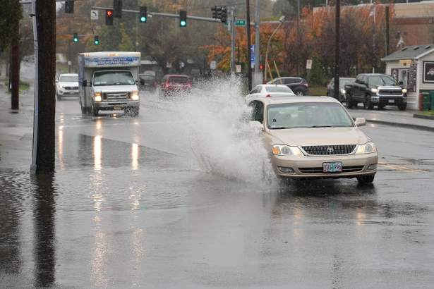
A strong autumn system is moving into the Pacific Northwest, bringing rain, powerful wind gusts and a sharp temperature drop before calmer conditions return for the weekend.
The Wind Advisory issued for the Portland area is part of a broader first major fall storm moving across Oregon and southwest Washington. The National Weather Service says the Portland-area advisory runs from 3 a.m. to 11 a.m. Friday, with south winds of 15 to 25 mph and gusts reaching up to 45 mph.
The storm is also bringing widespread rain, cooler temperatures and the possibility of isolated thunderstorms across parts of the Pacific Northwest. KATU describes it as the region’s first fall storm, while KOMO reports a significant autumn system moving through western Washington.
Background and Context
The transition from summer to fall is arriving quickly across the Pacific Northwest.
According to KATU, a strong cold front was expected to move through northwest Oregon and southwest Washington overnight Thursday into Friday morning. Rain was forecast to spread from the Oregon Coast into the Coast Range and Willamette Valley.
The same system is affecting western Washington.
KOMO reported that widespread rain, gusty winds and cooler weather would arrive Friday, with the strongest winds expected along the coast and Strait of Juan de Fuca.
The National Weather Service’s Portland office issued a Wind Advisory covering Portland, parts of the Willamette Valley, southwest Washington and surrounding communities. The advisory warns that gusty winds could blow around unsecured objects, damage tree limbs and cause some power outages.
The weather shift is especially noticeable because temperatures are dropping sharply.
KATU reported that Portland could fall from around 70 degrees Thursday afternoon to about 62 degrees Friday, with afternoon highs struggling to reach the mid-60s over the weekend.
Latest Update: Wind Advisory Covers Portland Friday Morning


6
The Wind Advisory is in effect across a wide area surrounding Portland.
The National Weather Service says the advisory covers portions of the Portland metro area, Tualatin Valley, Willamette Valley and nearby southwest Washington communities.
The advisory period is:
- Start: 3 a.m. PDT Friday
- End: 11 a.m. PDT Friday
- Expected winds: South winds 15 to 25 mph
- Potential gusts: Up to 45 mph
- Primary concerns: Falling limbs, unsecured objects and isolated power outages
The weather service also warns that trees with full leaf cover may be more vulnerable to wind damage even at lower wind speeds.
A separate advisory for the Upper Hood River Valley calls for southwest winds with gusts up to 50 mph Friday.
That means the strongest conditions will not necessarily be limited to downtown Portland.
Heavy Rain Arrives With the First Fall Storm
Wind is only part of the story.
KATU reports that rain will first spread along the Oregon Coast before moving across the Coast Range and into the Willamette Valley overnight. Rain is expected to become more scattered Friday afternoon as the main front moves east.
There is also a possibility of isolated thunderstorms.
KATU says stronger showers or thunderstorms could briefly produce heavier rain and stronger wind gusts. The station also notes a possibility of funnel clouds developing with some stronger cells, particularly as showers move off the Coast Range toward communities west of the Portland metro area.
The National Weather Service forecast for Portland calls for showers and a possible thunderstorm Friday, with a 90% chance of precipitation and wind gusts potentially reaching 45 mph.
Portland Temperatures Take a Sharp Turn
The storm is also changing the temperature profile across the region.
KATU reported that Portland was expected to drop from roughly 70 degrees Thursday afternoon to around 62 degrees Friday. The cooler pattern was expected to continue through the weekend.
The National Weather Service forecast is consistent with that shift, calling for a Friday high near 61 degrees in Portland, followed by partly sunny conditions Saturday with a high around 64 degrees.
That makes Friday feel much more like early autumn than late summer.
Western Washington Faces Its Own Wind and Rain Threat
The Wind Advisory story extends beyond Oregon.
KOMO reports that western Washington is also facing its first significant autumn storm of the season. Rain was expected to spread inland Friday, with Seattle, Tacoma and Everett seeing steadier precipitation later than the coast.
KOMO forecasts between a half-inch and 1 inch of rain across many areas, with higher totals possible in the Olympics and Cascades.
Wind will be a particular concern near the coast and Strait of Juan de Fuca, where gusts of 30 to 50 mph are possible.
The National Weather Service’s Seattle office similarly describes the system as a stronger, more fall-like system bringing widespread rain and gusty winds to western Washington.
Why the Wind Advisory Matters
A Wind Advisory does not mean every location will experience damaging winds.
Instead, it identifies a period when winds are strong enough to create meaningful hazards, particularly for drivers, pedestrians and property owners.
For the Portland area, the National Weather Service specifically recommends extra caution for high-profile vehicles and securing outdoor objects that could be blown around.
Potential problems include:
- Tree branches falling
- Garbage cans and lightweight outdoor objects blowing away
- Difficult driving conditions for high-profile vehicles
- Scattered power outages
- Reduced visibility during heavier rain
- Sudden bursts of stronger wind near showers or thunderstorms
The combination of saturated ground and gusty winds can also increase the potential for branches and weaker limbs to come down.
What Residents Should Watch Friday Morning
The timing of the advisory is important.
The Portland-area warning begins at 3 a.m., covering the early morning period when many people may be commuting.
The National Weather Service advises drivers to use extra caution, particularly those operating high-profile vehicles.
Residents can also reduce potential problems by securing outdoor furniture, garbage cans, decorations and other lightweight objects before the strongest winds arrive.
Power outages are another possibility.
Both the National Weather Service and local television forecasts identify falling limbs and isolated outages as potential impacts.
Expert Analysis: Why This Storm Marks a Seasonal Shift
The defining feature of this system is not simply rain.
It is the combination of several changes arriving together.
First, a stronger frontal system is moving through.
Second, temperatures are falling significantly.
Third, wind speeds are increasing.
Fourth, the pattern is expected to become calmer after the front moves through.
That combination makes the storm feel like a genuine seasonal transition.
KOMO describes the system as a significant autumn storm, while the National Weather Service calls it a stronger, more fall-like system.
The storm also demonstrates how quickly conditions can change in the Pacific Northwest during the transition into autumn.
Rain Could Help Reduce Wildfire Smoke
There is another important consequence to the wetter pattern.
KOMO reports that the rain could slow wildfire activity and reduce smoke across western Washington, although larger fires could continue smoldering and become more active once conditions turn dry again.
KATU similarly identifies the storm’s rain and cooler temperatures as a significant change from the warmer conditions that preceded it.
That does not mean wildfire risk disappears.
It means the weather is temporarily becoming less favorable for continued fire activity in areas receiving meaningful rain and cooler conditions.
Broader Implications
The arrival of the first major fall storm has implications beyond Friday’s commute.
Travel
Strong crosswinds can be particularly challenging for high-profile vehicles.
The National Weather Service specifically warns drivers to use extra caution during the advisory period.
Power Infrastructure
Falling branches can damage power lines, potentially causing scattered outages.
This is one reason residents are being advised to prepare before the strongest winds arrive.
Outdoor Activities
Friday’s combination of rain, wind and cooler temperatures creates very different conditions from the preceding warm weather.
Outdoor plans may need to account for changing conditions, especially during the morning hours.
Wildfire Conditions
Rain and cooler weather could temporarily reduce fire activity and smoke, although the longer-term situation depends on how quickly dry conditions return.
For more technology and weather-related coverage, an internal link could point readers to The Tech Marketer’s weather and climate coverage.
Pacific Northwest Weather Is Moving Into Its Fall Pattern
The current system is part of a familiar Pacific Northwest seasonal transition.
Fall often brings a shift from the region’s comparatively dry summer pattern toward more frequent frontal systems, rain and stronger wind events.
What makes this particular system notable is the sharp change occurring over a short period.
Portland is moving from temperatures around 70 degrees Thursday afternoon toward the low 60s Friday, while western Washington is also transitioning into a cooler, wetter pattern.
The weekend outlook is considerably calmer.
The National Weather Service expects Portland to turn partly sunny Saturday, with Sunday also looking mostly sunny.
KOMO likewise expects drier conditions and cooler sunshine across western Washington over the weekend.
What Happens Next?
The immediate focus is Friday morning.
For Portland, the Wind Advisory runs through 11 a.m. PDT.
Rain and showers may continue beyond the advisory period, and thunderstorms remain possible during the afternoon.
Conditions should gradually settle after the front passes.
Portland
- Friday: Rain, showers and possible thunderstorms
- Friday wind: Gusts potentially up to 45 mph
- Saturday: Partly sunny and cooler
- Sunday: Mostly sunny
- Temperatures: Remaining cooler than Thursday
Western Washington
KOMO expects showers to continue through Friday night and into Saturday morning in the Cascades, while lowland areas should turn drier over the weekend.
The National Weather Service also expects drier conditions across western Washington over the weekend.
Conclusion
The Wind Advisory affecting Portland is one piece of a broader first fall storm sweeping across the Pacific Northwest.
The system is bringing widespread rain, gusty winds and a significant temperature drop to Oregon, southwest Washington and western Washington.
In Portland, the National Weather Service advisory covers the early Friday morning period, with south winds of 15 to 25 mph and gusts reaching up to 45 mph.
KATU expects the storm to bring rain, gusty winds and isolated thunderstorms before conditions become more scattered Friday afternoon.
Western Washington is facing a similar transition, with widespread rain and gusty winds followed by a drier weekend.
For residents across the region, the message is straightforward: secure loose outdoor items, be cautious during the morning commute and keep an eye on updated local forecasts.
The storm may be brief, but it marks a clear shift toward fall weather across the Pacific Northwest.
FAQ
1. What is the Wind Advisory for Portland?
The Wind Advisory is in effect from 3 a.m. to 11 a.m. PDT Friday for Portland and surrounding areas. South winds of 15 to 25 mph with gusts up to 45 mph are expected.
2. How strong will the winds be in Portland?
The National Weather Service forecasts south winds of 15 to 25 mph, with gusts reaching up to 45 mph in the advisory area.
3. Will Portland get heavy rain?
Rain is expected to spread through the region overnight and Friday, with showers and a possible thunderstorm during the day.
4. When does the Wind Advisory end?
The Portland-area advisory is scheduled to end at 11 a.m. PDT Friday.
5. Could there be power outages?
Yes. The National Weather Service says falling tree limbs could result in a few power outages, while KOMO also identifies isolated outages as a possibility in western Washington.
6. Will temperatures drop after the storm?
Yes. Portland is expected to fall from around 70 degrees Thursday afternoon to about 62 degrees Friday, with cooler conditions continuing into the weekend.
7. Will the weather improve this weekend?
Forecasts call for drier and calmer conditions over the weekend. Portland is expected to turn partly sunny Saturday and mostly sunny Sunday.
8. Is this the first major fall storm?
Local coverage describes the system as the first significant or major fall storm of the season for the Pacific Northwest. KATU calls it the region’s first fall storm, while KOMO describes it as western Washington’s first significant autumn storm.
SOURCES & REFERENCES
- KATU: First Fall storm brings heavy rain, gusty winds and a big cooldown to Oregon, SW Wash.
- KOMO News: Windy, rainy fall weather arrives Friday before weekend sunshine returns
- KOIN: Wind Advisory in place for Portland on Friday morning. Here’s what to know
- National Weather Service Portland: Wind Advisory
- National Weather Service: Portland forecast